Bikepacking the Collegiate Peaks
Janet and I decided to squeeze in a quick Colorado bikepacking trip that we designed based on a combination of the “Sage and Saddles” route as well as the “Vapor Trail” route – both...
Exploring good routes and bad ones to help you decide where to go
Hobie Tandem Island Sailboat / Routes
by Brian · Published October 2, 2024 · Last modified October 6, 2024
For a long time, I had dreamt of doing adventures in our tandem kayak. After a somewhat frightening final crossing during our Channel Islands Crossing voyage, we decided to scale back kayaking the open...
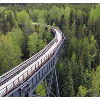
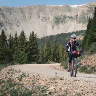
Bicycling / Bike Packing / Routes
by Brian · Published July 22, 2024 · Last modified August 11, 2024
Janet and I decided to squeeze in a quick Colorado bikepacking trip that we designed based on a combination of the “Sage and Saddles” route as well as the “Vapor Trail” route – both...
Bike Packing / Bike Touring / Bikepacking Western Africa / Routes
by Brian · Published February 9, 2024 · Last modified March 3, 2024
I spent 100 days riding from Morocco to Ghana on a full suspension Mountain Bike during the fall of 2023. It was a fantastic trip with a lot of “ups” and just a couple...
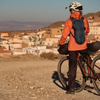
Bike Packing / Bike Touring / Bikepacking Spain / Routes
by Brian · Published August 8, 2023 · Last modified February 27, 2024
Description Coming Soon
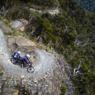
Bicycling / Bike Packing / Bike Touring / Routes
by Brian · Published May 22, 2023 · Last modified July 13, 2023
Suggested 3wk Itinerary | List of all NZ GREAT RIDES | Our Photos | NZ Likes/Dislikes I had been toying with the idea of bikepacking New Zealand for many years; ever since I heard...
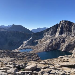
Backpacking / Fastpacking / Foot Travel / Routes
by Brian · Published October 6, 2022 · Last modified June 15, 2023
A perfect Sierra weather report suddenly materialized in early October 2022. I dropped everything I was doing and set to finalize a route that I had been sketching through the Tablelands East of the...
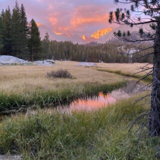
Backpacking / Fastpacking / Foot Travel / Routes
by Brian · Published September 30, 2022 · Last modified March 3, 2024
I’ve been meaning to start a trip from the Horseshoe Meadows / Cottonwood Lakes Trail head – which I’d never done before. With the exception of the trip to Funston Lake, this route follows...
Bicycling / Bike Packing / Bike Touring / Routes
by Brian · Published June 30, 2022 · Last modified March 3, 2024
In the summer of 2022, our friend Mark Glenesk invited Janet and me to ride a combination of rail trails in the Pacific Northwest. Below is a light account of our journey. Starting with...
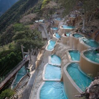
Bicycling / Bike Packing / Bike Touring / Bike Touring Latin America / Routes
by Brian · Published March 26, 2022 · Last modified March 3, 2024
In 2014, Janet and I rode from San Diego to Panama. This was our first multi-month tour together, and because Honduras had such a bad reputation for safety, we tried our best to avoid...

When is a carb not a carb? The great fructose experiment.
August 4, 2023


My Type 1 Diabetes Diagnosis Story
May 31, 2021


Type 1 Diabetes FAQs – What food do you miss the most?
November 12, 2018

Type 1 Diabetes FAQs – You Can’t Eat That, Right?
November 3, 2018

Symlin for use in Type 1 Diabetes
October 30, 2018


August 22, 2017

August 23, 2015

Ionian Basin Traverse and Tehipite Gorge
July 17, 2015
Type 1 Diabetes FAQs – What food do you miss the most?
November 12, 2018

Little Sur River Fastpack Exploration
November 14, 2015
More

Utah Bikepacking – All The Routes
September 30, 2021

Bikepacking Death Valley – Valle de la Muerte
February 12, 2021

Wandering the West Bikepack trip
October 23, 2020

October 10, 2019

October 9, 2018

January 12, 2018

December 8, 2015

August 23, 2015